
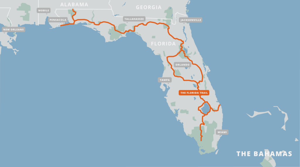
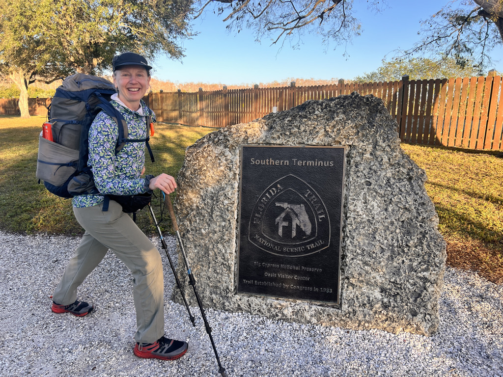
Big Cypress: Southern Terminus to 13 Mile Camp, 17 miles
Day One is fairly dry in the Big Cypress Preserve with only hints of what is yet to come.
Big Cypress: 13 Mile Camp to Ivy Camp, 10 miles
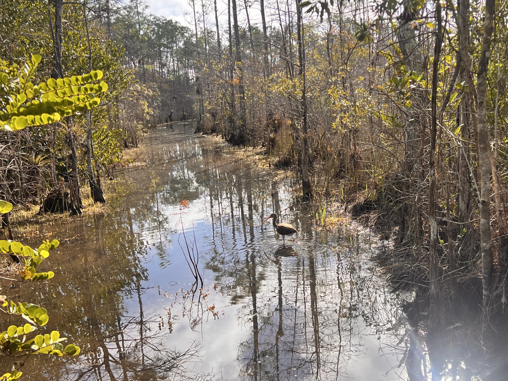
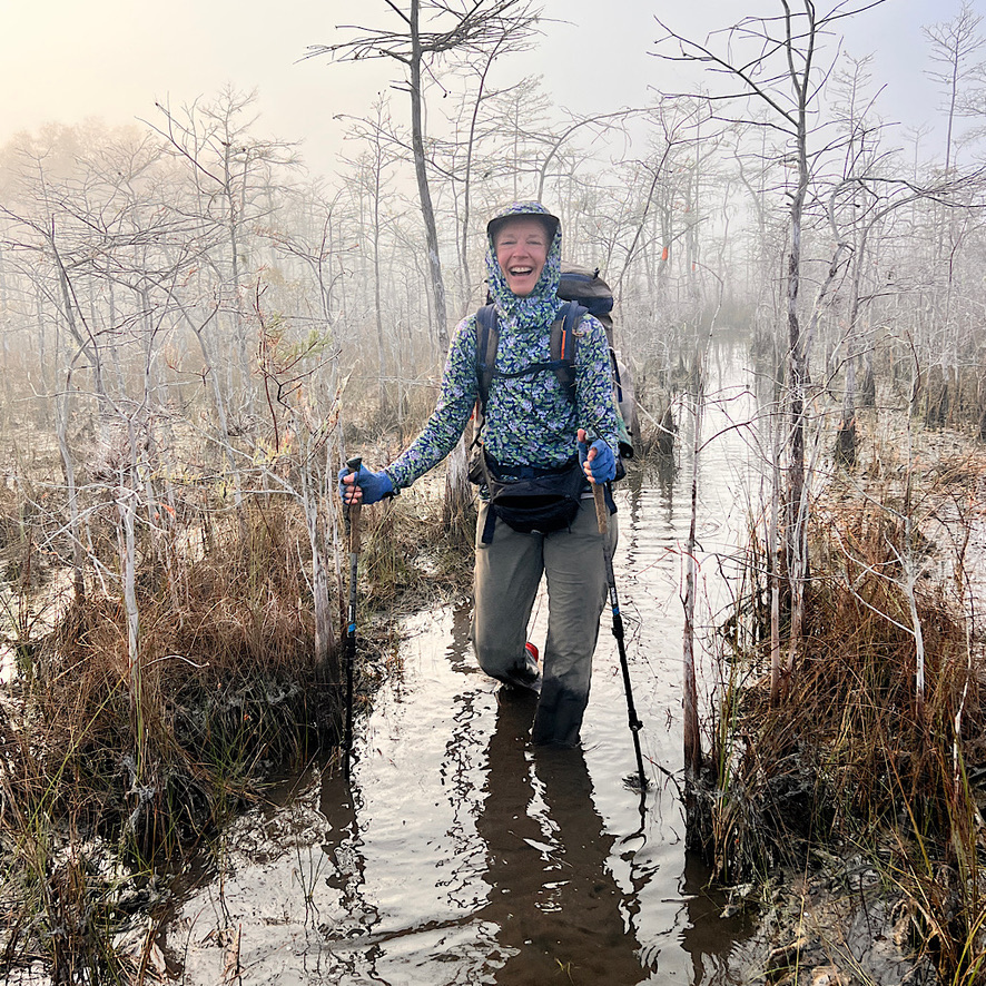
The hardest bits of the entire Florida Trail lie in the Big Cypress. For nearly ten miles, the trail works its way through swamp requiring wading through water and mud.
Big Cypress: Ivy Camp to Nobles Camp, 9 miles
It’s only a few short, messy miles out of the swamp which I share with an FKT (Fastest Known Time) seeker names Torry like old friends.
Big Cypress/Seminole: Nobles to New Testament Church, 13 miles
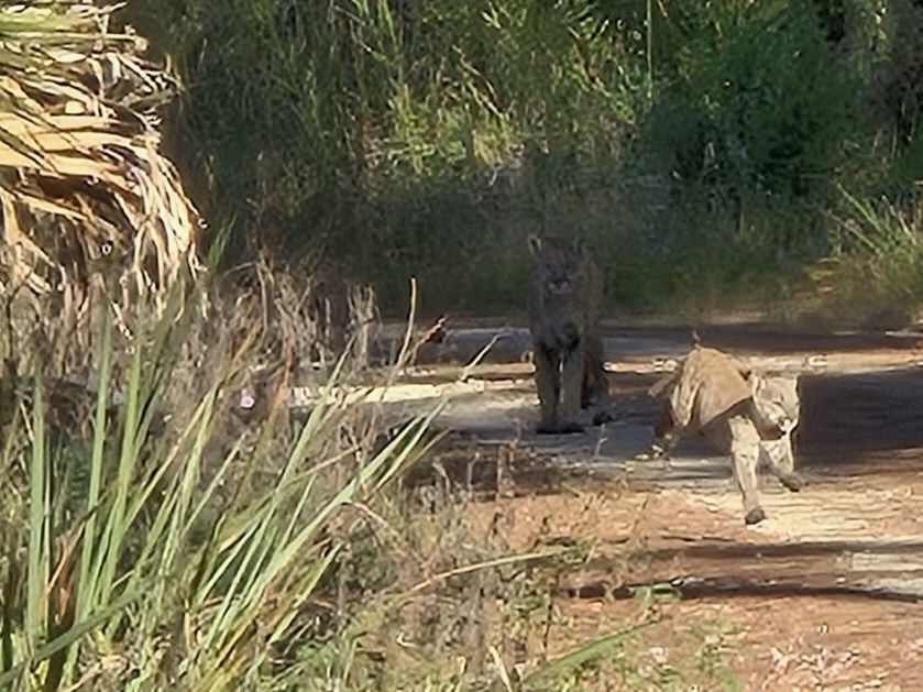
It’s an easy day of walking which allows me to visit the museum and Swamp Cafe in the Seminole Reservation – plus catch a glimpse of a panther.
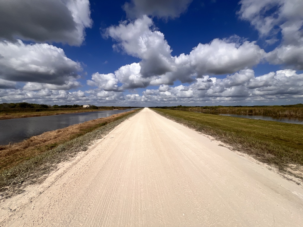
Canals: Seminole Reservation to STA 5/6 campsite, 19 miles
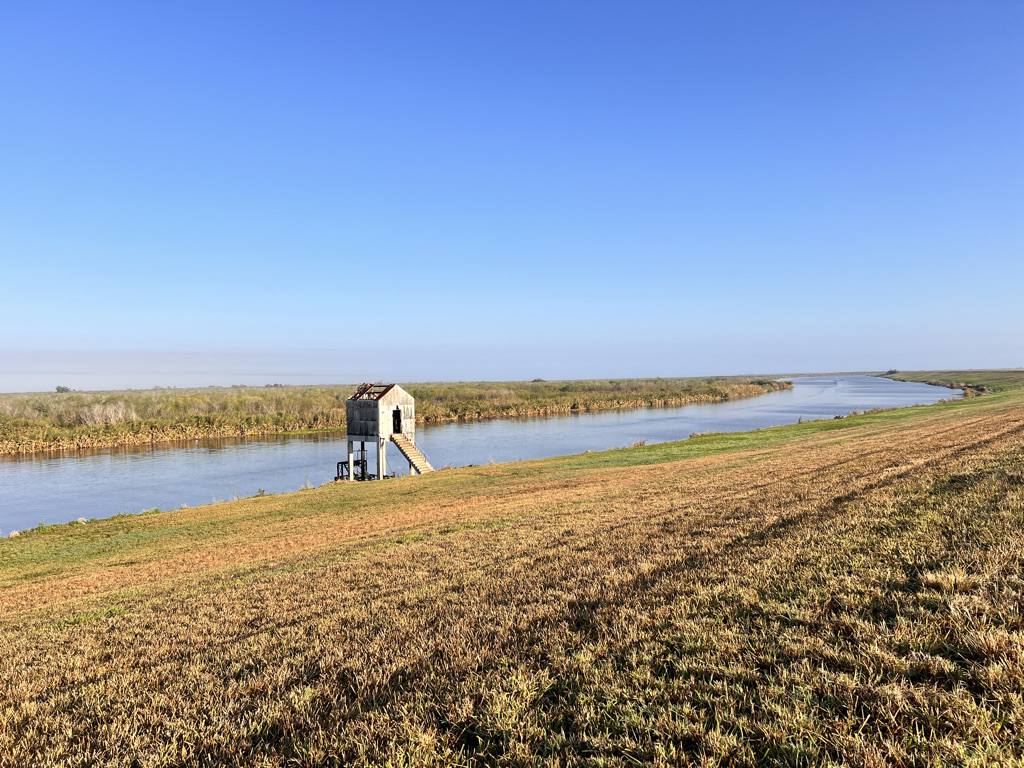
The first day on the canals – the drained swamps of the everglades south of Lake Okeechobee – is long and shadeless, but surprisingly full of life.
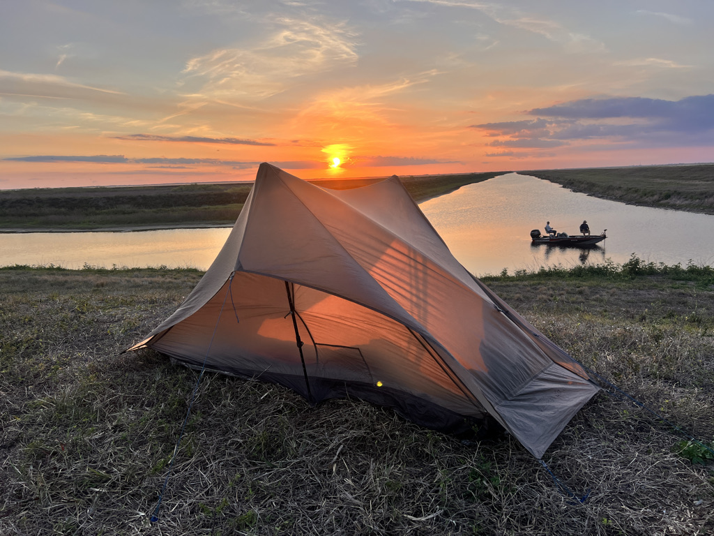
Canals: STA 5/6 campsite to L1-E campsite, 16 miles
The second day on the canals is mostly on a road away from the water until finally popping back onto the levee and a gorgeous campsite.
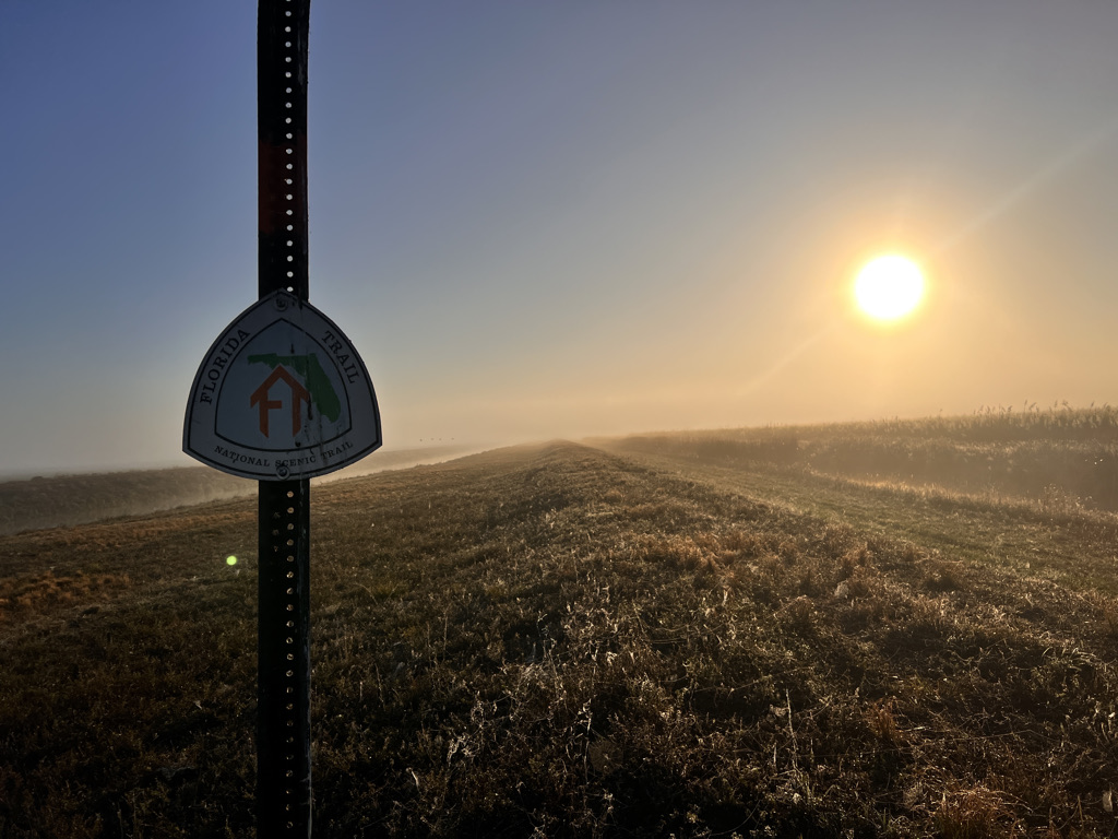
Canals/Okeechobee: L1-E to Torry Island, 20 miles
The trail is now through mowed grass and heads towards the lake where a lovely couple offers me lunch and I get a much-needed shower at an RV park.
Lake Okeechobee: Torry Island to Canal Point, 17 miles
It’s a shorter day to Pahokee where I eat wonderful Mexican food, then walk a few more miles before camping on Cindy’s lawn.
Lake Okeechobee: Canal Point to S-135 campsite, 17 miles
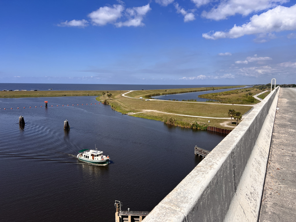
The trail goes up and over Port Mayaca on a vertiginous bridge, then hits a beautiful section along a canal where I camp with my high school friend.
Okeechobee: S-135 campsite to Okeechobee, 15 miles
It’s not much further to town and a shower/rest! The lake enchants as well as a cool sculpture park in Okeechobee.
Kissimmee: Okeechobee to Chandler Slough East, 20 miles
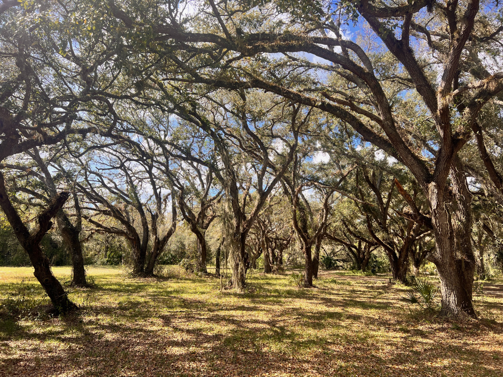
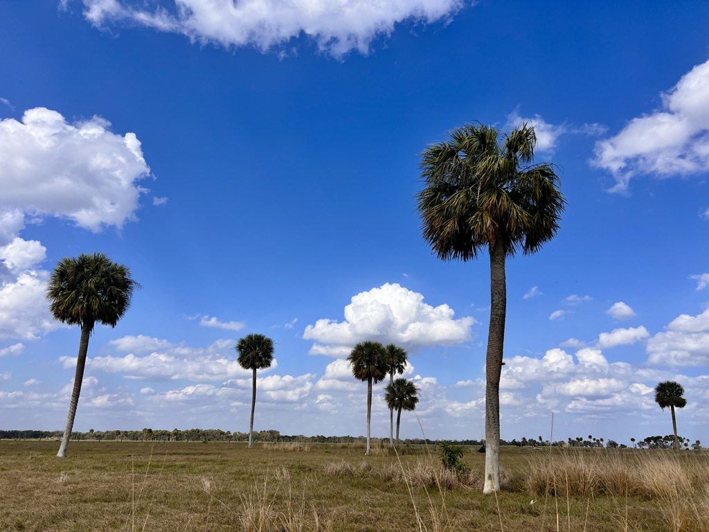
Leaving lake Okeechobee, I follow the Kissimmee River and miles of mystical oak hammocks.
Kissimmee: Chandler Slough East to Oak Creek Hammock, 20 miles
It’s an extraordinary day in the Kissimmee through palm and oak hammocks ending with a full moon.
Kissimmee: Oak Creek Hammock to Cowboy Crossing, 17 miles
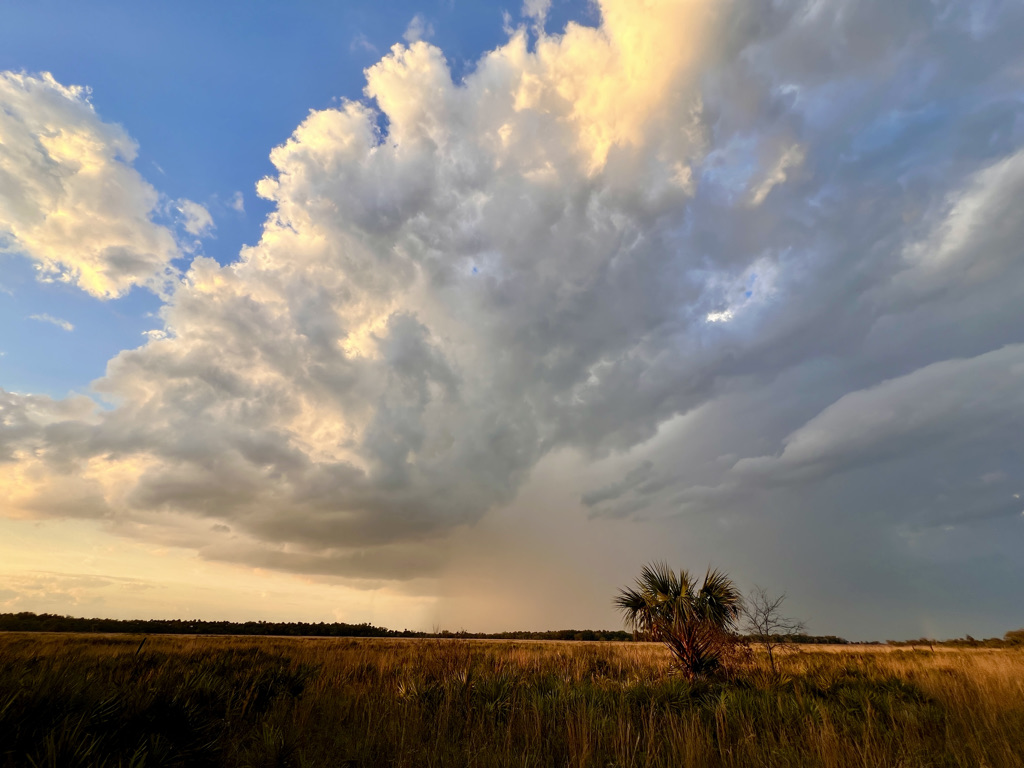
It’s another beautiful day in the hammocks and prairie, where I watch a downpour from a safe distance.
Kissimmee: Cowboy Crossing to Long Hammock, 20 miles
I luck out with the weather and an overcast sky on a hot day, plus I’m able to take a shortcut through normally an alligator-infested cypress strand because it’s so dry.
Kissimmee: Long Hammock to SR 60, 6 miles
It’s a short day to the highway where I’ll meet my friend, so I hang out at my campsite all morning in the hammock, then visit the chaos of River Ranch.